
A New Map of London 1800
Sale price
£50.00
Delivery Information
Additional Information
Individually handmade in the family-run workshop of craftsman Phillip Burrough, this map is laid on high-quality cloth and beautifully presented in an antique marbled slip case.
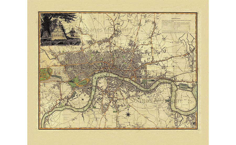
This rare edition of Robert Laurie & James Whittle's copper engraved map of London was published in 1800. Published just a few years prior to the laying out of Regent's Park it shows that although London had rapidly expanded over the last hundred years or so open fields still lapped the edge of Hyde Park. The Isle of Dogs was still largely marsh land and Islington and Hackney still villages. Folding maps came into being in the mid-18th century when turnpike roads became extensive and good enough to make long-distance travel easier.
Specifications:
- Size: 70 x 90 cm
- Material: 100% Natural Cotton Cloth
